 Ameland
Current Status
Where is the vessel?
Ameland is currently in 16 nm W of Harboør, based on AIS data received about 14h ago.
Latest AIS update:
Current position: 56.62917° N, 7.69573° E (16 nm W of Harboør)
Average speed (last 7 days): Loading…
Average speed (last 30 days): Loading…
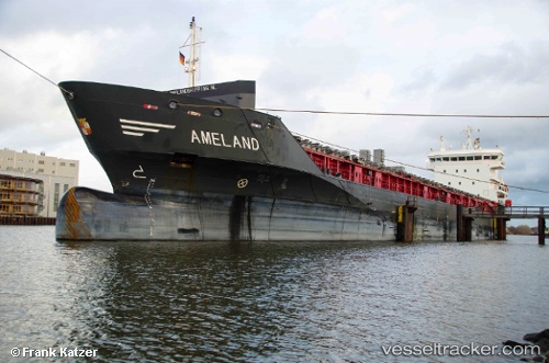
Vessel profile: Ameland is a Multi Purpose Carrier with dimensions 122m x 16m.
This page combines live AIS, route history, probable destination signals, nearby traffic, and port activity for practical vessel monitoring.
The current position of vessel Ameland is 56.62917 lat / 7.69573 lng. Updated: 2026-05-20 06:06:01 UTCNearest reference points:
- Near Thyborøn
- 36 nm W of HVIDE SANDE
- Near Kleppen
Currently sailing under the flag of Netherlands ![]()
Ameland built in 2009 year
Deadweight:
7133 tDetails:
Live Vessel Ameland Analytics (details, animations, etc.)
Recent AIS points (UTC):
2026-05-20 02:07:47 UTC · 57.18653, 8.44011 · SOG 10.9 kn · COG 230°2026-05-20 04:09:11 UTC · 56.90546, 8.02464 · SOG 10.6 kn · COG 213°
2026-05-20 04:43:20 UTC · 56.82151, 7.92377 · SOG 10.5 kn · COG 214°
2026-05-20 06:06:01 UTC · 56.62917, 7.69573 · SOG 9.9 kn · COG 210°