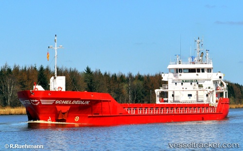
 Scheldedijk
Current Status
Where is the vessel?
Scheldedijk is currently in 16 nm SE of Sant Jaume d'Enveja, based on AIS data received about 14h ago.
Latest AIS update:
Current position: 40.47780° N, 0.90045° E (16 nm SE of Sant Jaume d'Enveja)
Average speed (last 7 days): Loading…
Average speed (last 30 days): Loading…
Vessel profile: Scheldedijk is a Multi Purpose Carrier with dimensions 90m x 14m.
This page combines live AIS, route history, probable destination signals, nearby traffic, and port activity for practical vessel monitoring.
The current position of vessel Scheldedijk is 40.47780 lat / 0.90045 lng. Updated: 2026-05-19 19:34:12 UTCNearest reference points:
- Near San Carlos de la Rápita
- 24 nm SW of Sampedor
- Near CAMBRILS
Currently sailing under the flag of Netherlands ![]()
Scheldedijk built in 2010 year
Deadweight:
4891 tDetails:
Live Vessel Scheldedijk Analytics (details, animations, etc.)
Recent AIS points (UTC):
2026-05-19 16:14:10 UTC · 40.02524, 0.34044 · SOG 11 kn · COG 44°2026-05-19 17:26:31 UTC · 40.19057, 0.53783 · SOG 11.4 kn · COG 40°
2026-05-19 19:31:30 UTC · 40.47154, 0.89349 · SOG 10.9 kn · COG 40°
2026-05-19 19:34:12 UTC · 40.47780, 0.90045 · SOG 10.9 kn · COG 40°