 MINOAS
Current Status
Where is the vessel?
MINOAS is currently in Near Taku Bar, based on AIS data received about 14h ago.
Latest AIS update:
Current position: 38.94582° N, 118.08208° E (Near Taku Bar)
Average speed (last 7 days): Loading…
Average speed (last 30 days): Loading…
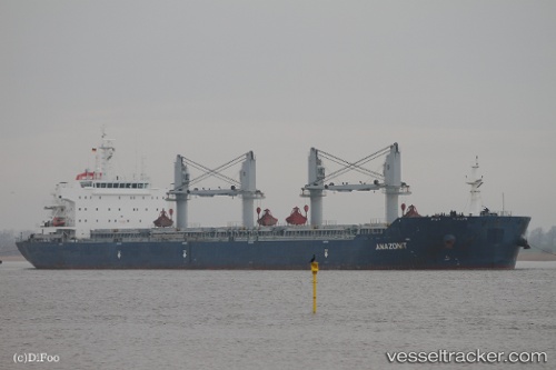
Vessel profile: MINOAS is a Bulk Carrier with dimensions 32m x 190m.
This page combines live AIS, route history, probable destination signals, nearby traffic, and port activity for practical vessel monitoring.
The current position of vessel MINOAS is 38.94582 lat / 118.08208 lng. Updated: 2026-05-22 11:17:34 UTCNearest reference points:
- Near Dagu Bar
- Near Taku Bar
- Near Tianjin Pt
Currently sailing under the flag of Marshall Islands ![]()
MINOAS built in 2011 year
Deadweight:
56952 tDetails:
Live Vessel MINOAS Analytics (details, animations, etc.)
Recent AIS points (UTC):
2026-05-22 08:29:20 UTC · 38.94578, 118.08243 · SOG 0 kn · COG -1°2026-05-22 09:02:20 UTC · 38.94593, 118.08230 · SOG 0 kn · COG 134°
2026-05-22 09:02:20 UTC · 38.94593, 118.08230 · SOG 0 kn · COG 134°
2026-05-22 11:17:34 UTC · 38.94582, 118.08208 · SOG 0 kn · COG -1°