 Patria
Current Status
Where is the vessel?
Patria is currently in 21 nm SE of Wolfersdorf, based on AIS data received about 14h ago.
Latest AIS update:
Current position: 48.27833° N, 11.42666° W (21 nm SE of Wolfersdorf)
Average speed (last 7 days): Loading…
Average speed (last 30 days): Loading…
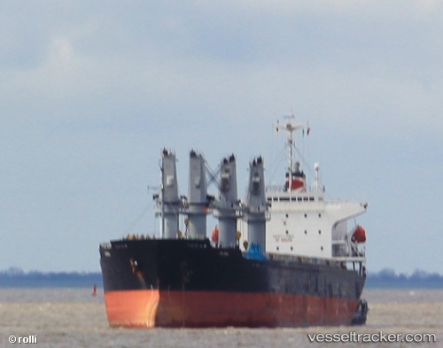
Vessel profile: Patria is a Bulk Carrier with dimensions 175m x 175m.
This page combines live AIS, route history, probable destination signals, nearby traffic, and port activity for practical vessel monitoring.
The current position of vessel Patria is 48.27833 lat / -11.42666 lng. Updated: 2026-05-22 01:21:36 UTCNearest reference points:
- 44 nm SE of Brady
- 24 nm N of Aurach Bei Kitzbuhel
Currently sailing under the flag of Liberia ![]()
Details:
Live Vessel Patria Analytics (details, animations, etc.)
Recent AIS points (UTC):
2026-05-21 19:55:53 UTC · 49.25453, -11.35417 · SOG 10 kn · COG 194°2026-05-21 22:00:52 UTC · 48.88148, -11.38061 · SOG 11.2 kn · COG 190°
2026-05-21 22:21:41 UTC · 48.81833, -11.38333 · SOG 10 kn · COG -1°
2026-05-22 01:21:36 UTC · 48.27833, -11.42666 · SOG 11 kn · COG -1°