 vesseltracker.com
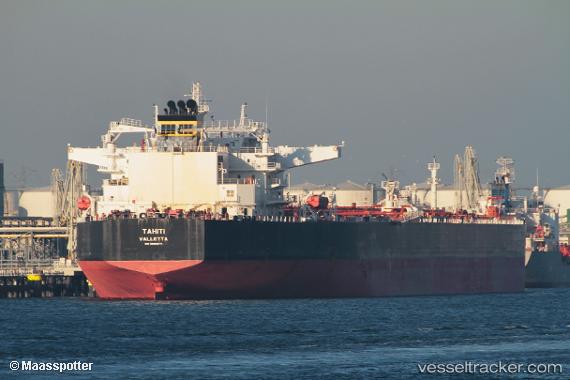
Tahiti
Current StatusWhere is the vessel?
Tahiti is currently in 80 nm NE of Alozaina, based on AIS data received about 15h ago.
Latest AIS update:
Current position: 37.46500° N, 13.45667° W (80 nm NE of Alozaina)
Average speed (last 7 days): Loading…
Average speed (last 30 days): Loading…
Vessel profile: Tahiti is a Crude Oil Tanker with dimensions 48m x 273m.
This page combines live AIS, route history, probable destination signals, nearby traffic, and port activity for practical vessel monitoring.
The current position of vessel Tahiti is 37.46500 lat / -13.45667 lng. Updated: 2026-05-18 01:19:22 UTCNearest reference points:
- 97 nm W of Los Ramos
- 74 nm E of Alozaina
- 95 nm W of Los Ramos
Details:
Live Vessel Tahiti Analytics (details, animations, etc.)
Recent AIS points (UTC):
2026-05-17 22:16:19 UTC · 37.66833, -14.24167 · SOG 12 kn · COG -1°2026-05-17 23:22:19 UTC · 37.59500, -13.95833 · SOG 12 kn · COG -1°
2026-05-18 01:19:22 UTC · 37.46500, -13.45667 · SOG 12 kn · COG -1°
2026-05-18 01:19:22 UTC · 37.46500, -13.45667 · SOG 12 kn · COG -1°