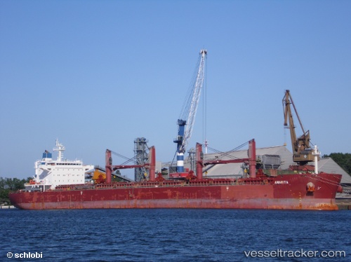
 Anarita
Current Status
Where is the vessel?
Anarita is currently in 127 nm SE of Porto Santo Island, based on AIS data received about 14h ago.
Latest AIS update:
Current position: 31.96681° N, 14.18106° W (127 nm SE of Porto Santo Island)
Average speed (last 7 days): Loading…
Average speed (last 30 days): Loading…
Vessel profile: Anarita is a Bulk Carrier with dimensions 190m x 33m.
This page combines live AIS, route history, probable destination signals, nearby traffic, and port activity for practical vessel monitoring.
The current position of vessel Anarita is 31.96681 lat / -14.18106 lng. Updated: 2026-05-20 17:32:40 UTCNearest reference points:
- 148 nm SE of Porto Santo Island
- 109 nm E of Porto Santo Island
- 101 nm SW of Jarjis
Currently sailing under the flag of Liberia ![]()
Anarita built in 2012 year
Deadweight:
58018 tDetails:
Live Vessel Anarita Analytics (details, animations, etc.)
Recent AIS points (UTC):
2026-05-20 13:36:15 UTC · 31.35045, -14.36052 · SOG 10.1 kn · COG 13°2026-05-20 16:05:48 UTC · 31.74669, -14.24640 · SOG 9.5 kn · COG 14°
2026-05-20 16:50:52 UTC · 31.86086, -14.21171 · SOG 9.3 kn · COG 14°
2026-05-20 17:32:40 UTC · 31.96681, -14.18106 · SOG 9.5 kn · COG 14°