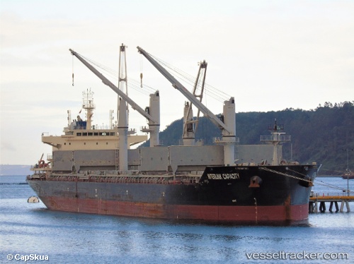
Interlink Capacity
Current StatusWhere is the vessel?
Interlink Capacity is currently in 22 nm S of Hettimulla, based on AIS data received about 15h ago.
Latest AIS update:
Current position: 6.91500° N, 80.18333° W (22 nm S of Hettimulla)
Average speed (last 7 days): Loading…
Average speed (last 30 days): Loading…
Vessel profile: Interlink Capacity is a Bulk Carrier with dimensions 32m x 179m.
This page combines live AIS, route history, probable destination signals, nearby traffic, and port activity for practical vessel monitoring.
The current position of vessel Interlink Capacity is 6.91500 lat / -80.18333 lng. Updated: 2026-05-19 08:07:52 UTCNearest reference points:
- 20 nm S of El Puerto
- 30 nm E of El Cirial (Isla Iguana)
- Near Saboga
Details:
Live Vessel Interlink Capacity Analytics (details, animations, etc.)
Recent AIS points (UTC):
2026-05-19 04:39:55 UTC · 6.89636, -80.95359 · SOG 14.3 kn · COG 92°2026-05-19 06:22:10 UTC · 6.89141, -80.54931 · SOG 13.9 kn · COG 85°
2026-05-19 07:13:56 UTC · 6.89333, -80.36333 · SOG 12 kn · COG -1°
2026-05-19 08:07:52 UTC · 6.91500, -80.18333 · SOG 12 kn · COG -1°