 Interlink Utility
Current Status
Where is the vessel?
Interlink Utility is currently in 83 nm SE of Alcobaca, based on AIS data received about 14h ago.
Latest AIS update:
Current position: 18.19500° S, 37.93833° W (83 nm SE of Alcobaca)
Average speed (last 7 days): Loading…
Average speed (last 30 days): Loading…
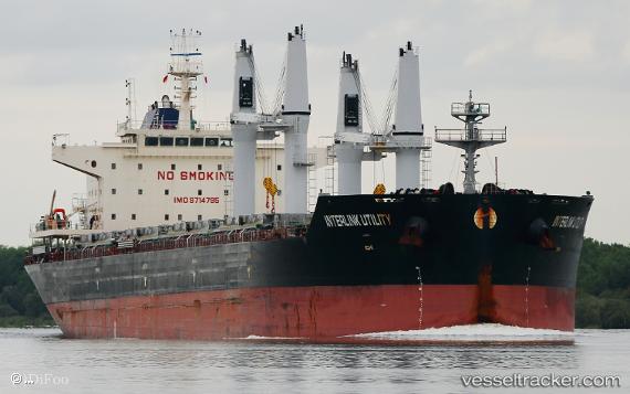
Vessel profile: Interlink Utility is a Bulk Carrier with dimensions 180m x 32m.
This page combines live AIS, route history, probable destination signals, nearby traffic, and port activity for practical vessel monitoring.
The current position of vessel Interlink Utility is -18.19500 lat / -37.93833 lng. Updated: 2026-05-19 04:16:15 UTCNearest reference points:
- 91 nm E of Conceicao da Barra
- 169 nm E of Alcobaca
- Near Tubarão Pt./Vitória
Currently sailing under the flag of Marshall Is ![]()
Details:
Live Vessel Interlink Utility Analytics (details, animations, etc.)
Recent AIS points (UTC):
2026-05-19 01:55:15 UTC · -17.79833, -37.73167 · SOG 11 kn · COG -1°2026-05-19 02:07:54 UTC · -17.83552, -37.74893 · SOG 11.3 kn · COG 205°
2026-05-19 04:13:14 UTC · -18.18667, -37.93333 · SOG 11 kn · COG -1°
2026-05-19 04:16:15 UTC · -18.19500, -37.93833 · SOG 11 kn · COG -1°