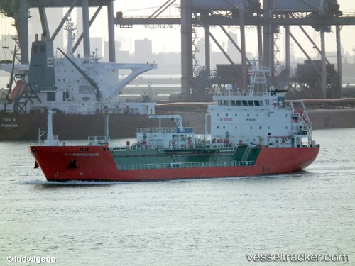
Syn Turais
Current StatusWhere is the vessel?
Syn Turais is currently in 17 nm SW of Saint Antioco Ponti, based on AIS data received about 14h ago.
Latest AIS update:
Current position: 38.79565° N, 8.30332° E (17 nm SW of Saint Antioco Ponti)
Average speed (last 7 days): Loading…
Average speed (last 30 days): Loading…
Vessel profile: Syn Turais is a Lpg Tanker with dimensions 16m x 95m.
This page combines live AIS, route history, probable destination signals, nearby traffic, and port activity for practical vessel monitoring.
The current position of vessel Syn Turais is 38.79565 lat / 8.30332 lng. Updated: 2026-05-19 19:29:24 UTCNearest reference points:
- Near CARLOFORTE
- Near SARROCH
- Near Cagliari
Details:
Live Vessel Syn Turais Analytics (details, animations, etc.)
Recent AIS points (UTC):
2026-05-19 16:20:34 UTC · 38.88723, 9.09515 · SOG 12.2 kn · COG 225°2026-05-19 17:22:14 UTC · 38.77145, 8.87414 · SOG 12.5 kn · COG 257°
2026-05-19 19:29:24 UTC · 38.79565, 8.30332 · SOG 12.3 kn · COG 281°
2026-05-19 19:29:24 UTC · 38.79565, 8.30332 · SOG 12.3 kn · COG 281°