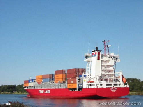
 Livland
Current Status
Where is the vessel?
Livland is currently in Near Oulu (Uleåborg), based on AIS data received about 15h ago.
Latest AIS update:
Current position: 64.99720° N, 25.41612° E (Near Oulu (Uleåborg))
Average speed (last 7 days): Loading…
Average speed (last 30 days): Loading…
Vessel profile: Livland is a General Cargo with dimensions 100m x 16m.
This page combines live AIS, route history, probable destination signals, nearby traffic, and port activity for practical vessel monitoring.
The current position of vessel Livland is 64.99720 lat / 25.41612 lng. Updated: 2026-05-20 13:49:59 UTCNearest reference points:
- Near Karlsborg Axelvik
Currently sailing under the flag of Portugal ![]()
Livland built in 2001 year
Deadweight:
5464 tDetails:
Live Vessel Livland Analytics (details, animations, etc.)
Recent AIS points (UTC):
2026-05-20 10:16:57 UTC · 64.99719, 25.41610 · SOG 0 kn · COG 319°2026-05-20 11:34:58 UTC · 64.99716, 25.41614 · SOG 0 kn · COG 319°
2026-05-20 13:01:59 UTC · 64.99722, 25.41614 · SOG 0 kn · COG 320°
2026-05-20 13:49:59 UTC · 64.99720, 25.41612 · SOG 0 kn · COG 320°