 GELMOND 2
Current Status
Where is the vessel?
GELMOND 2 is currently in Near TEKIRDAG, based on AIS data received about 14h ago.
Latest AIS update:
Current position: 40.96517° N, 27.50603° E (Near TEKIRDAG)
Average speed (last 7 days): Loading…
Average speed (last 30 days): Loading…
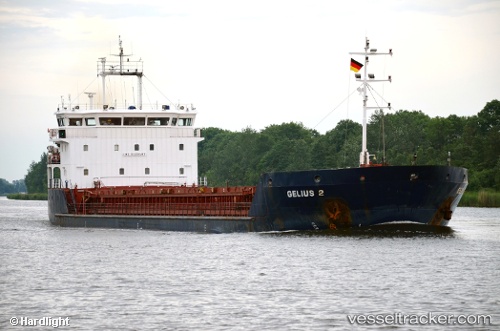
Vessel profile: GELMOND 2 is a General Cargo Ship with dimensions 90m x 16m.
This page combines live AIS, route history, probable destination signals, nearby traffic, and port activity for practical vessel monitoring.
The current position of vessel GELMOND 2 is 40.96517 lat / 27.50603 lng. Updated: 2026-05-22 18:01:38 UTCNearest reference points:
- Near TEKIRDAG
- Near Saraylar
- Near Sarköy
Currently sailing under the flag of St.Kitts and Nevis ![]()
GELMOND 2 built in 2008 year
Deadweight:
5492 tDetails:
Live Vessel GELMOND 2 Analytics (details, animations, etc.)
Recent AIS points (UTC):
2026-05-22 13:49:34 UTC · 40.96516, 27.50602 · SOG 0 kn · COG 121°2026-05-22 15:31:35 UTC · 40.96515, 27.50602 · SOG 0 kn · COG 121°
2026-05-22 16:13:36 UTC · 40.96515, 27.50602 · SOG 0 kn · COG 121°
2026-05-22 18:01:38 UTC · 40.96517, 27.50603 · SOG 0 kn · COG 121°