 SAM
SAM
Current Status
Where is the vessel?
SAM is currently in Near Davutpasa, based on AIS data received about 14h ago.
Latest AIS update:
Current position: 40.97301° N, 28.93753° E (Near Davutpasa)
Average speed (last 7 days): Loading…
Average speed (last 30 days): Loading…
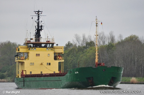
Vessel profile: SAM is a General Cargo Ship with dimensions 84m x 12m.
This page combines live AIS, route history, probable destination signals, nearby traffic, and port activity for practical vessel monitoring.
The current position of vessel SAM is 40.97301 lat / 28.93753 lng. Updated: 2026-05-19 10:10:40 UTCNearest reference points:
- Near Davutpasa
- Near ZEYTINBURNU
- Near Mardas
Currently sailing under the flag of Togo ![]()
SAM built in 1976 year
Deadweight:
3160 tDetails:
Live Vessel SAM Analytics (details, animations, etc.)
Recent AIS points (UTC):
2026-05-19 07:03:11 UTC · 40.97313, 28.93706 · SOG 0 kn · COG 182°2026-05-19 08:21:30 UTC · 40.97310, 28.93728 · SOG 0 kn · COG 197°
2026-05-19 10:07:50 UTC · 40.97301, 28.93752 · SOG 0 kn · COG 208°
2026-05-19 10:10:40 UTC · 40.97301, 28.93753 · SOG 0 kn · COG 209°