 vesseltracker.com
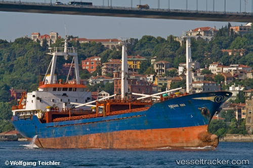
 Hacereana
Current Status
Where is the vessel?
Hacereana is currently in Near RUMELI FENERI, based on AIS data received about 14h ago.
Latest AIS update:
Current position: 41.25933° N, 29.08403° E (Near RUMELI FENERI)
Average speed (last 7 days): Loading…
Average speed (last 30 days): Loading…
Vessel profile: Hacereana is a General Cargo Ship with dimensions 81m x 11m.
This page combines live AIS, route history, probable destination signals, nearby traffic, and port activity for practical vessel monitoring.
The current position of vessel Hacereana is 41.25933 lat / 29.08403 lng. Updated: 2026-05-18 02:18:54 UTCNearest reference points:
- Near RUMELI FENERI
- Near Istinye/Istambul
- Near Kavacik
Currently sailing under the flag of Turkey ![]()
Hacereana built in 1980 year
Deadweight:
3178 tDetails:
Live Vessel Hacereana Analytics (details, animations, etc.)
Recent AIS points (UTC):
2026-05-17 23:06:54 UTC · 41.26054, 29.08260 · SOG 0 kn · COG 49°2026-05-17 23:39:54 UTC · 41.26042, 29.08279 · SOG 0 kn · COG 61°
2026-05-18 02:15:54 UTC · 41.25924, 29.08396 · SOG 0 kn · COG 247°
2026-05-18 02:18:54 UTC · 41.25933, 29.08403 · SOG 0 kn · COG 247°