 Kaya Tuna
Current Status
Where is the vessel?
Kaya Tuna is currently in Near Aliaga, based on AIS data received about 14h ago.
Latest AIS update:
Current position: 38.82524° N, 26.94699° E (Near Aliaga)
Average speed (last 7 days): Loading…
Average speed (last 30 days): Loading…
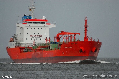
Vessel profile: Kaya Tuna is a Chemical Oil Products Tanker with dimensions 128m x 21m.
This page combines live AIS, route history, probable destination signals, nearby traffic, and port activity for practical vessel monitoring.
The current position of vessel Kaya Tuna is 38.82524 lat / 26.94699 lng. Updated: 2026-05-18 21:35:06 UTCNearest reference points:
- Near Aliaga
- Near Nemrut Bay
- Near NEMRUT
Currently sailing under the flag of Turkey ![]()
Kaya Tuna built in 2007 year
Deadweight:
13027 tDetails:
Live Vessel Kaya Tuna Analytics (details, animations, etc.)
Recent AIS points (UTC):
2026-05-18 18:20:07 UTC · 38.82526, 26.94698 · SOG 0 kn · COG 193°2026-05-18 19:27:33 UTC · 38.82523, 26.94697 · SOG 0 kn · COG -1°
2026-05-18 20:02:09 UTC · 38.82523, 26.94698 · SOG 0 kn · COG 193°
2026-05-18 21:35:06 UTC · 38.82524, 26.94699 · SOG 0 kn · COG 194°