 vesseltracker.com
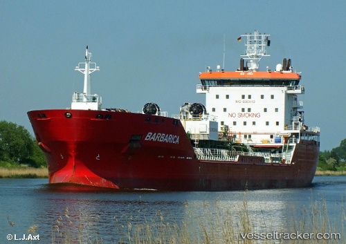
 Barbarica
Current Status
Where is the vessel?
Barbarica is currently in Near Gela, based on AIS data received about 14h ago.
Latest AIS update:
Current position: 37.02471° N, 14.22661° E (Near Gela)
Average speed (last 7 days): Loading…
Average speed (last 30 days): Loading…
Vessel profile: Barbarica is a Chemical Oil Products Tanker with dimensions 148m x 23m.
This page combines live AIS, route history, probable destination signals, nearby traffic, and port activity for practical vessel monitoring.
The current position of vessel Barbarica is 37.02471 lat / 14.22661 lng. Updated: 2026-05-17 20:07:59 UTCNearest reference points:
- Near Gela
- Near Scoglitti
- Near Licata
Currently sailing under the flag of Malta ![]()
Barbarica built in 2007 year
Deadweight:
18818 tDetails:
Live Vessel Barbarica Analytics (details, animations, etc.)
Recent AIS points (UTC):
2026-05-17 16:17:01 UTC · 37.02349, 14.22837 · SOG 0.4 kn · COG 272°2026-05-17 18:04:58 UTC · 37.02349, 14.22839 · SOG 0 kn · COG 269°
2026-05-17 19:32:02 UTC · 37.02400, 14.22811 · SOG 0.2 kn · COG 243°
2026-05-17 20:07:59 UTC · 37.02471, 14.22661 · SOG 0.3 kn · COG 183°