 vesseltracker.com
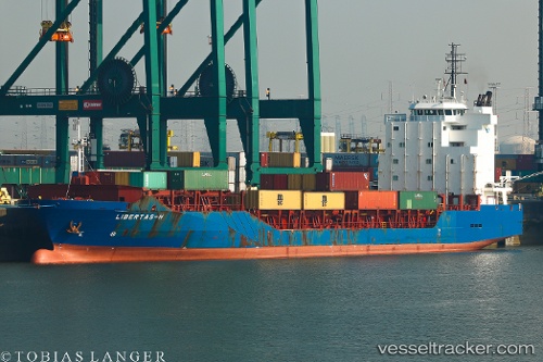
 Libertas h
Current Status
Where is the vessel?
Libertas h is currently in Near Sestri Ponente, based on AIS data received less than 1h ago.
Latest AIS update:
Current position: 44.40751° N, 8.88337° E (Near Sestri Ponente)
Average speed (last 7 days): Loading…
Average speed (last 30 days): Loading…
Vessel profile: Libertas h is a Multi Purpose Carrier with dimensions 128m x 20m.
This page combines live AIS, route history, probable destination signals, nearby traffic, and port activity for practical vessel monitoring.
The current position of vessel Libertas h is 44.40751 lat / 8.88337 lng. Updated: 2026-05-18 07:51:50 UTCNearest reference points:
- Near Sestri Ponente
- Near Genova
- Near Multedo
Currently sailing under the flag of Portugal ![]()
Libertas h built in 2007 year
Deadweight:
8716 tDetails:
Live Vessel Libertas h Analytics (details, animations, etc.)
Recent AIS points (UTC):
2026-05-18 04:47:35 UTC · 44.40754, 8.88330 · SOG 0 kn · COG 174°2026-05-18 05:29:42 UTC · 44.40756, 8.88331 · SOG 0.1 kn · COG 174°
2026-05-18 07:39:51 UTC · 44.40752, 8.88335 · SOG 0.1 kn · COG 174°
2026-05-18 07:51:50 UTC · 44.40751, 8.88337 · SOG 0 kn · COG 174°