 GELMOND 2
Current Status
Where is the vessel?
GELMOND 2 is currently in Near Marmara Ereglisi, based on AIS data received about 14h ago.
Latest AIS update:
Current position: 40.83686° N, 28.05462° E (Near Marmara Ereglisi)
Average speed (last 7 days): Loading…
Average speed (last 30 days): Loading…
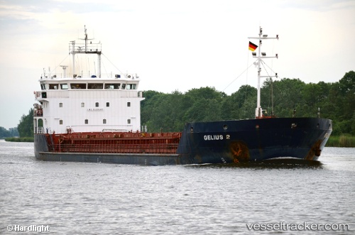
Vessel profile: GELMOND 2 is a General Cargo Ship with dimensions 90m x 16m.
This page combines live AIS, route history, probable destination signals, nearby traffic, and port activity for practical vessel monitoring.
The current position of vessel GELMOND 2 is 40.83686 lat / 28.05462 lng. Updated: 2026-05-19 01:36:22 UTCNearest reference points:
- Near Saraylar
- 11 nm E of Erdek
- Near Gürpinar
Currently sailing under the flag of St.Kitts and Nevis ![]()
GELMOND 2 built in 2008 year
Deadweight:
5492 tDetails:
Live Vessel GELMOND 2 Analytics (details, animations, etc.)
Recent AIS points (UTC):
2026-05-18 22:50:12 UTC · 40.89918, 28.61093 · SOG 9.3 kn · COG 261°2026-05-18 23:34:03 UTC · 40.87949, 28.46437 · SOG 9.1 kn · COG 266°
2026-05-19 01:30:03 UTC · 40.83991, 28.07598 · SOG 9.4 kn · COG 258°
2026-05-19 01:36:22 UTC · 40.83686, 28.05462 · SOG 9.3 kn · COG 256°