 vesseltracker.com
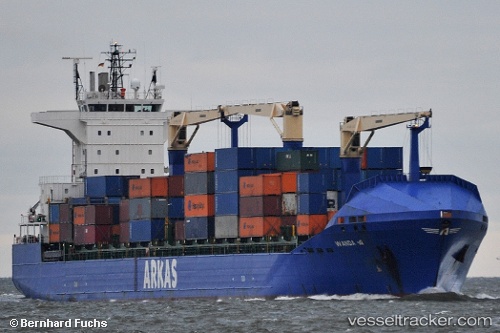
 WANDA A
Current Status
Where is the vessel?
WANDA A is currently in Near Kabatas, based on AIS data received about 16h ago.
Latest AIS update:
Current position: 41.03187° N, 29.00697° E (Near Kabatas)
Average speed (last 7 days): Loading…
Average speed (last 30 days): Loading…
Vessel profile: WANDA A is a Container Ship with dimensions 184m x 184m.
This page combines live AIS, route history, probable destination signals, nearby traffic, and port activity for practical vessel monitoring.
The current position of vessel WANDA A is 41.03187 lat / 29.00697 lng. Updated: 2026-05-17 23:40:32 UTCNearest reference points:
- Near Kabatas
- Near Uskudar
- Near Beyoglu
Currently sailing under the flag of Malta ![]()
WANDA A built in 2009 year
Deadweight:
21990 tDetails:
Live Vessel WANDA A Analytics (details, animations, etc.)
Recent AIS points (UTC):
2026-05-17 19:33:18 UTC · 40.72609, 28.89781 · SOG 0.2 kn · COG 3°2026-05-17 21:54:01 UTC · 40.78202, 28.92557 · SOG 9.3 kn · COG 28°
2026-05-17 23:03:58 UTC · 40.93045, 28.99707 · SOG 8.2 kn · COG 358°
2026-05-17 23:40:32 UTC · 41.03187, 29.00697 · SOG 12.4 kn · COG 55°