 vesseltracker.com
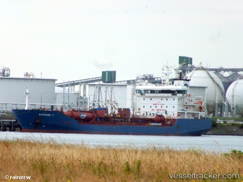
 KATTEGAT
Current Status
Where is the vessel?
KATTEGAT is currently in 14 nm S of Glommen, based on AIS data received about 15h ago.
Latest AIS update:
Current position: 56.71070° N, 12.21572° E (14 nm S of Glommen)
Average speed (last 7 days): Loading…
Average speed (last 30 days): Loading…
Vessel profile: KATTEGAT is a Chemical/Oil Products Tanker with dimensions 130m x 18m.
This page combines live AIS, route history, probable destination signals, nearby traffic, and port activity for practical vessel monitoring.
The current position of vessel KATTEGAT is 56.71070 lat / 12.21572 lng. Updated: 2026-05-18 07:51:17 UTCNearest reference points:
- Near FALKENBERG
- Near Varberg
- 11 nm NW of Tisvilde
Currently sailing under the flag of Denmark (DIS) ![]()
KATTEGAT built in 2008 year
Deadweight:
11299 tDetails:
Live Vessel KATTEGAT Analytics (details, animations, etc.)
Recent AIS points (UTC):
2026-05-18 04:49:06 UTC · 56.16005, 12.48275 · SOG 10.8 kn · COG 311°2026-05-18 05:33:36 UTC · 56.28802, 12.39195 · SOG 11.3 kn · COG 349°
2026-05-18 07:38:48 UTC · 56.67205, 12.23170 · SOG 11.4 kn · COG 348°
2026-05-18 07:51:17 UTC · 56.71070, 12.21572 · SOG 11.5 kn · COG 348°