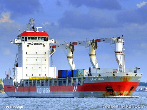
Albanyborg
Current StatusWhere is the vessel?
Albanyborg is currently in 48 nm NW of Finström, based on AIS data received about 14h ago.
Latest AIS update:
Current position: 61.00531° N, 19.27591° E (48 nm NW of Finström)
Average speed (last 7 days): Loading…
Average speed (last 30 days): Loading…
Vessel profile: Albanyborg is a General Cargo Ship with dimensions 21m x 143m.
This page combines live AIS, route history, probable destination signals, nearby traffic, and port activity for practical vessel monitoring.
The current position of vessel Albanyborg is 61.00531 lat / 19.27591 lng. Updated: 2026-05-19 19:34:51 UTCNearest reference points:
- Near Finström
- Near Östhammar
- Near MARIEHAMN
Details:
Live Vessel Albanyborg Analytics (details, animations, etc.)
Recent AIS points (UTC):
2026-05-19 16:21:41 UTC · 60.44556, 19.03043 · SOG 10.4 kn · COG 2°2026-05-19 17:25:01 UTC · 60.62534, 19.09596 · SOG 10.8 kn · COG 12°
2026-05-19 19:29:32 UTC · 60.98974, 19.26839 · SOG 10.8 kn · COG 12°
2026-05-19 19:34:51 UTC · 61.00531, 19.27591 · SOG 10.8 kn · COG 12°