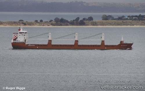
Molengracht
Current StatusWhere is the vessel?
Molengracht is currently in 18 nm SE of Vilanova de Arousa, based on AIS data received about 18h ago.
Latest AIS update:
Current position: 42.36206° N, 80.54500° W (18 nm SE of Vilanova de Arousa)
Average speed (last 7 days): Loading…
Average speed (last 30 days): Loading…
Vessel profile: Molengracht is a General Cargo Ship with dimensions 19m x 143m.
This page combines live AIS, route history, probable destination signals, nearby traffic, and port activity for practical vessel monitoring.
The current position of vessel Molengracht is 42.36206 lat / -80.54500 lng. Updated: 2026-05-18 13:32:16 UTCNearest reference points:
- Near Hannon
- Near Linndale
- Near OAKVILLE
Details:
Live Vessel Molengracht Analytics (details, animations, etc.)
Recent AIS points (UTC):
2026-05-18 13:32:16 UTC · 42.36206, -80.54500 · SOG 12.9 kn · COG 248°2026-05-18 13:32:16 UTC · 42.36206, -80.54500 · SOG 12.9 kn · COG 248°
2026-05-18 13:32:16 UTC · 42.36206, -80.54500 · SOG 12.9 kn · COG 248°
2026-05-18 13:32:16 UTC · 42.36206, -80.54500 · SOG 12.9 kn · COG 248°