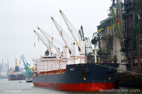
Golf
Current StatusWhere is the vessel?
Golf is currently in 35 nm E of Magdalena, based on AIS data received about 14h ago.
Latest AIS update:
Current position: 35.16490° S, 56.93682° W (35 nm E of Magdalena)
Average speed (last 7 days): Loading…
Average speed (last 30 days): Loading…
Vessel profile: Golf is a Bulk Carrier with dimensions 30m x 180m.
This page combines live AIS, route history, probable destination signals, nearby traffic, and port activity for practical vessel monitoring.
The current position of vessel Golf is -35.16490 lat / -56.93682 lng. Updated: 2026-05-20 04:11:12 UTCNearest reference points:
- 16 nm N of Cabo San Antonio
- Near JUAN LACAZE
- Near Dock Sur
Details:
Live Vessel Golf Analytics (details, animations, etc.)
Recent AIS points (UTC):
2026-05-19 23:28:13 UTC · -34.74665, -57.64748 · SOG 9.5 kn · COG 104°2026-05-20 01:39:03 UTC · -34.91011, -57.29977 · SOG 8.4 kn · COG 140°
2026-05-20 01:41:02 UTC · -34.91386, -57.29593 · SOG 9 kn · COG 140°
2026-05-20 04:11:12 UTC · -35.16490, -56.93682 · SOG 10.1 kn · COG 94°