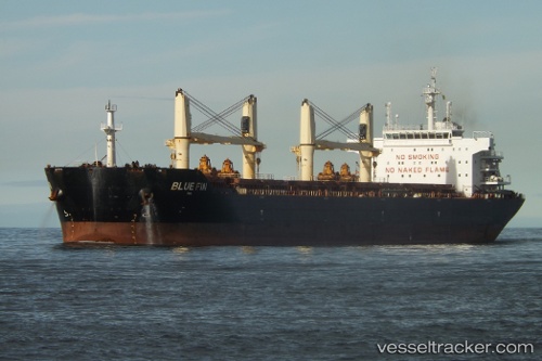
Blue Fin
Current StatusWhere is the vessel?
Blue Fin is currently in 109 nm W of Gageohyangri, based on AIS data received about 14h ago.
Latest AIS update:
Current position: 34.14840° N, 122.89700° E (109 nm W of Gageohyangri)
Average speed (last 7 days): Loading…
Average speed (last 30 days): Loading…
Vessel profile: Blue Fin is a Bulk Carrier with dimensions 32m x 190m.
This page combines live AIS, route history, probable destination signals, nearby traffic, and port activity for practical vessel monitoring.
The current position of vessel Blue Fin is 34.1484 lat / 122.897 lng. Updated: 2026-05-20 18:57:06 UTCNearest reference points:
- 111 nm W of Gageohyangri
- 102 nm W of Gageohyangri
- 108 nm W of Gageohyangri
Details:
Live Vessel Blue Fin Analytics (details, animations, etc.)
Recent AIS points (UTC):
2026-05-20 15:01:54 UTC · 34.95590, 122.91100 · SOG 13.7 kn · COG 181°2026-05-20 16:57:31 UTC · 34.53170, 122.90300 · SOG 12 kn · COG -1°
2026-05-20 18:09:30 UTC · 34.29830, 122.89800 · SOG 11 kn · COG -1°
2026-05-20 18:57:06 UTC · 34.14840, 122.89700 · SOG 11.3 kn · COG 180°