 vesseltracker.com
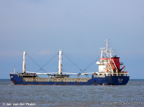
 Unlu 5
Current Status
Where is the vessel?
Unlu 5 is currently in 22 nm NE of Kapakli, based on AIS data received less than 1h ago.
Latest AIS update:
Current position: 41.55217° N, 28.33750° E (22 nm NE of Kapakli)
Average speed (last 7 days): Loading…
Average speed (last 30 days): Loading…
Vessel profile: Unlu 5 is a General Cargo Ship with dimensions 99m x 99m.
This page combines live AIS, route history, probable destination signals, nearby traffic, and port activity for practical vessel monitoring.
The current position of vessel Unlu 5 is 41.55217 lat / 28.33750 lng. Updated: 2026-05-12 19:51:49 UTCNearest reference points:
- 18 nm N of Istanbul New Airport
- Near IGNEADA
- 38 nm E of IGNEADA
Currently sailing under the flag of Turkey ![]()
Unlu 5 built in 2006 year
Deadweight:
5346 tDetails:
Live Vessel Unlu 5 Analytics (details, animations, etc.)
Recent AIS points (UTC):
2026-05-12 16:24:49 UTC · 41.55482, 28.33840 · SOG 0.2 kn · COG 253°2026-05-12 17:39:47 UTC · 41.55297, 28.33848 · SOG 0.9 kn · COG 273°
2026-05-12 19:42:48 UTC · 41.55218, 28.33763 · SOG 0 kn · COG 343°
2026-05-12 19:51:49 UTC · 41.55217, 28.33750 · SOG 0.1 kn · COG 347°