 LADY SEMA
Current Status
Where is the vessel?
LADY SEMA is currently in Near Savona, based on AIS data received about 14h ago.
Latest AIS update:
Current position: 44.31473° N, 8.49960° E (Near Savona)
Average speed (last 7 days): Loading…
Average speed (last 30 days): Loading…
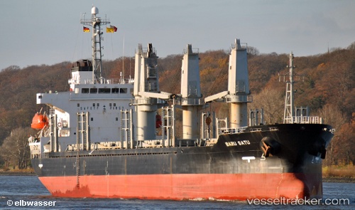
Vessel profile: LADY SEMA is a Bulk Carrier with dimensions 137m x 23m.
This page combines live AIS, route history, probable destination signals, nearby traffic, and port activity for practical vessel monitoring.
The current position of vessel LADY SEMA is 44.31473 lat / 8.49960 lng. Updated: 2026-05-19 10:05:42 UTCNearest reference points:
- Near Savona
- Near VARAZZE
- Near Finale Ligure
Currently sailing under the flag of Panama ![]()
LADY SEMA built in 2001 year
Deadweight:
16190 tDetails:
Live Vessel LADY SEMA Analytics (details, animations, etc.)
Recent AIS points (UTC):
2026-05-19 06:03:44 UTC · 44.31333, 8.49833 · SOG 0 kn · COG -1°2026-05-19 07:56:17 UTC · 44.31467, 8.49973 · SOG 0 kn · COG -1°
2026-05-19 08:05:12 UTC · 44.31462, 8.49968 · SOG 0 kn · COG -1°
2026-05-19 10:05:42 UTC · 44.31473, 8.49960 · SOG 0 kn · COG -1°