 vesseltracker.com
 New Island
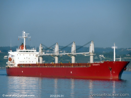
Current Status
Where is the vessel?
New Island is currently in Near Beloslav, based on AIS data received about 14h ago.
Latest AIS update:
Current position: 43.19450° N, 27.68733° E (Near Beloslav)
Average speed (last 7 days): Loading…
Average speed (last 30 days): Loading…
Vessel profile: New Island is a Bulk Carrier with dimensions 190m x 31m.
This page combines live AIS, route history, probable destination signals, nearby traffic, and port activity for practical vessel monitoring.
The current position of vessel New Island is 43.19450 lat / 27.68733 lng. Updated: 2026-05-18 05:55:05 UTCNearest reference points:
- Near Beloslav
- Near Ignatievo
- Near Varna
Currently sailing under the flag of Malta ![]()
New Island built in 2002 year
Deadweight:
47304 tDetails:
Live Vessel New Island Analytics (details, animations, etc.)
Recent AIS points (UTC):
2026-05-18 02:17:27 UTC · 43.19167, 27.66133 · SOG 0 kn · COG 296°2026-05-18 03:50:30 UTC · 43.19167, 27.66133 · SOG 0 kn · COG 296°
2026-05-18 04:14:30 UTC · 43.19167, 27.66133 · SOG 0 kn · COG 296°
2026-05-18 05:55:05 UTC · 43.19450, 27.68733 · SOG 7.2 kn · COG 75°