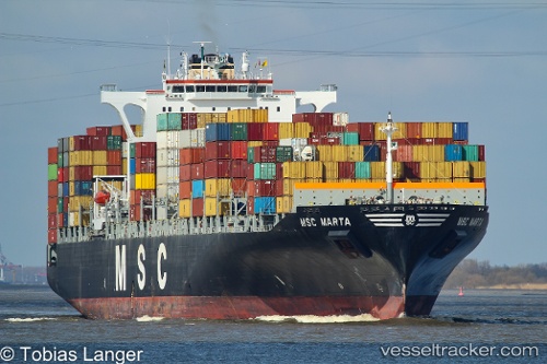
 Msc Marta
Current Status
Where is the vessel?
Msc Marta is currently in Near ZHOUSHAN, based on AIS data received about 15h ago.
Latest AIS update:
Current position: 29.80948° N, 122.16563° E (Near ZHOUSHAN)
Average speed (last 7 days): Loading…
Average speed (last 30 days): Loading…
Vessel profile: Msc Marta is a Container Ship with dimensions 275m x 275m.
This page combines live AIS, route history, probable destination signals, nearby traffic, and port activity for practical vessel monitoring.
The current position of vessel Msc Marta is 29.80948 lat / 122.16563 lng. Updated: 2026-05-22 20:06:18 UTCNearest reference points:
- 10 nm SE of Daxie Pt
- Near ZHOUSHAN
- 11 nm S of ZHOUSHAN
Currently sailing under the flag of Panama ![]()
Msc Marta built in 2005 year
Deadweight:
72044 tDetails:
Live Vessel Msc Marta Analytics (details, animations, etc.)
Recent AIS points (UTC):
2026-05-22 16:45:19 UTC · 29.80946, 122.16568 · SOG 0 kn · COG 77°2026-05-22 17:57:16 UTC · 29.80957, 122.16558 · SOG 0 kn · COG 77°
2026-05-22 19:51:19 UTC · 29.80948, 122.16562 · SOG 0 kn · COG 77°
2026-05-22 20:06:18 UTC · 29.80948, 122.16563 · SOG 0 kn · COG 77°