 vesseltracker.com
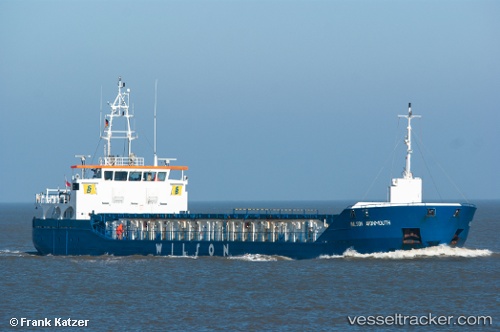
 WILSON AVONMOUTH
Current Status
Where is the vessel?
WILSON AVONMOUTH is currently in Near Rosyth, based on AIS data received about 1h ago.
Latest AIS update:
Current position: 56.01980° N, 3.44624° W (Near Rosyth)
Average speed (last 7 days): Loading…
Average speed (last 30 days): Loading…
Vessel profile: WILSON AVONMOUTH is a General Cargo Ship with dimensions 88m x 12m.
This page combines live AIS, route history, probable destination signals, nearby traffic, and port activity for practical vessel monitoring.
The current position of vessel WILSON AVONMOUTH is 56.01980 lat / -3.44624 lng. Updated: 2026-05-13 16:25:15 UTCNearest reference points:
- Near Leith
- Near BROUGHTY FERRY
- Near North Berwick
Currently sailing under the flag of Barbados ![]()
WILSON AVONMOUTH built in 2010 year
Deadweight:
3594 tDetails:
Live Vessel WILSON AVONMOUTH Analytics (details, animations, etc.)
Recent AIS points (UTC):
2026-05-13 13:25:14 UTC · 56.01980, -3.44623 · SOG 0 kn · COG 297°2026-05-13 13:49:14 UTC · 56.01981, -3.44624 · SOG 0 kn · COG 297°
2026-05-13 15:43:14 UTC · 56.01981, -3.44623 · SOG 0 kn · COG 297°
2026-05-13 16:25:15 UTC · 56.01980, -3.44624 · SOG 0 kn · COG 298°