 vesseltracker.com
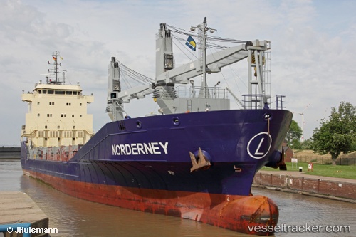
 Norderney
Current Status
Where is the vessel?
Norderney is currently in Near Sunny Point, based on AIS data received about 1h ago.
Latest AIS update:
Current position: 33.98788° N, 77.95491° W (Near Sunny Point)
Average speed (last 7 days): Loading…
Average speed (last 30 days): Loading…
Vessel profile: Norderney is a Multi Purpose Carrier with dimensions 108m x 108m.
This page combines live AIS, route history, probable destination signals, nearby traffic, and port activity for practical vessel monitoring.
The current position of vessel Norderney is 33.98788 lat / -77.95491 lng. Updated: 2026-05-12 22:33:19 UTCNearest reference points:
- Near North Myrtle Beach
- Near Morehead City
- Near BEAUFORT
Currently sailing under the flag of Antigua Barbuda ![]()
Norderney built in 2012 year
Deadweight:
5475 tDetails:
Live Vessel Norderney Analytics (details, animations, etc.)
Recent AIS points (UTC):
2026-05-12 19:14:39 UTC · 34.00613, -77.95404 · SOG 0 kn · COG 193°2026-05-12 19:38:35 UTC · 34.00614, -77.95403 · SOG 0 kn · COG 193°
2026-05-12 21:53:41 UTC · 34.00613, -77.95405 · SOG 0 kn · COG 193°
2026-05-12 22:33:19 UTC · 33.98788, -77.95491 · SOG 5 kn · COG 169°