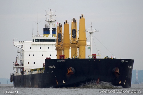
Elina B
Current StatusWhere is the vessel?
Elina B is currently in 111 nm W of Bentota River Apt, based on AIS data received about 14h ago.
Latest AIS update:
Current position: 5.85048° N, 78.21403° E (111 nm W of Bentota River Apt)
Average speed (last 7 days): Loading…
Average speed (last 30 days): Loading…
Vessel profile: Elina B is a Bulk Carrier with dimensions 32m x 196m.
This page combines live AIS, route history, probable destination signals, nearby traffic, and port activity for practical vessel monitoring.
The current position of vessel Elina B is 5.85048 lat / 78.21403 lng. Updated: 2026-05-20 03:21:32 UTCNearest reference points:
- 82 nm W of Moratuwa
- 90 nm W of Moratuwa
- 94 nm W of Dehiwala
Details:
Live Vessel Elina B Analytics (details, animations, etc.)
Recent AIS points (UTC):
2026-05-19 22:41:08 UTC · 6.23814, 77.42316 · SOG 11.7 kn · COG 116°2026-05-20 01:09:05 UTC · 6.03076, 77.85345 · SOG 11.3 kn · COG -1°
2026-05-20 01:54:15 UTC · 5.96613, 77.97780 · SOG 10.8 kn · COG -1°
2026-05-20 03:21:32 UTC · 5.85048, 78.21403 · SOG 11.1 kn · COG -1°