 vesseltracker.com
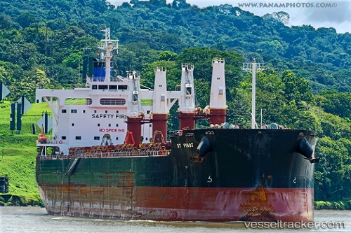
 St Pinot
Current Status
Where is the vessel?
St Pinot is currently in 244 nm SW of Benahavis, based on AIS data received about 2h ago.
Latest AIS update:
Current position: 34.24249° N, 54.64377° W (244 nm SW of Benahavis)
Average speed (last 7 days): Loading…
Average speed (last 30 days): Loading…
Vessel profile: St Pinot is a Bulk Carrier with dimensions 190m x 32m.
This page combines live AIS, route history, probable destination signals, nearby traffic, and port activity for practical vessel monitoring.
The current position of vessel St Pinot is 34.24249 lat / -54.64377 lng. Updated: 2026-04-02 15:37:34 UTCNearest reference points:
- 244 nm SW of Benahavis
- Open sea, approx. 403 nm off the nearest listed port
Currently sailing under the flag of Marshall Is ![]()
St Pinot built in 2013 year
Deadweight:
57949 tDetails:
Live Vessel St Pinot Analytics (details, animations, etc.)
Recent AIS points (UTC):
2026-04-02 10:19:21 UTC · 33.91916, -55.85326 · SOG 11.4 kn · COG 67°2026-04-02 11:55:50 UTC · 34.02842, -55.49759 · SOG 12 kn · COG 72°
2026-04-02 14:05:51 UTC · 34.15107, -54.99932 · SOG 12.1 kn · COG 72°
2026-04-02 15:37:34 UTC · 34.24249, -54.64377 · SOG 12 kn · COG 70°