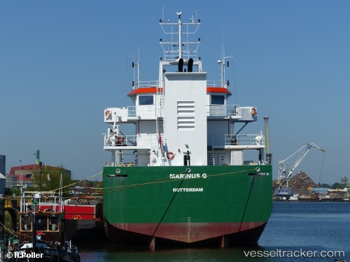
 Marinus G
Current Status
Where is the vessel?
Marinus G is currently in Near Wangerooge, based on AIS data received about 14h ago.
Latest AIS update:
Current position: 53.80238° N, 7.98564° E (Near Wangerooge)
Average speed (last 7 days): Loading…
Average speed (last 30 days): Loading…
Vessel profile: Marinus G is a Hopper Dredger with dimensions 85m x 85m.
This page combines live AIS, route history, probable destination signals, nearby traffic, and port activity for practical vessel monitoring.
The current position of vessel Marinus G is 53.80238 lat / 7.98564 lng. Updated: 2026-05-21 14:05:56 UTCNearest reference points:
- Near Wangerooge
- Near Horumersiel
- Near HOOKSIEL
Currently sailing under the flag of Netherlands ![]()
Marinus G built in 2010 year
Deadweight:
4300 tDetails:
Live Vessel Marinus G Analytics (details, animations, etc.)
Recent AIS points (UTC):
2026-05-21 11:04:35 UTC · 53.80122, 7.99991 · SOG 0.9 kn · COG -1°2026-05-21 11:33:15 UTC · 53.80238, 7.98600 · SOG 0.7 kn · COG -1°
2026-05-21 13:39:24 UTC · 53.80195, 7.98995 · SOG 1.7 kn · COG -1°
2026-05-21 14:05:56 UTC · 53.80238, 7.98564 · SOG 2.2 kn · COG -1°