 vesseltracker.com
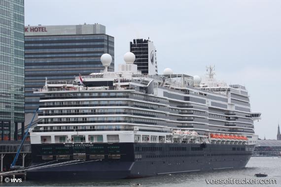
 Nieuw Statendam
Current Status
Where is the vessel?
Nieuw Statendam is currently in Near Cueva Bermeja, based on AIS data received about 1h ago.
Latest AIS update:
Current position: 28.47333° N, 16.24500° W (Near Cueva Bermeja)
Average speed (last 7 days): Loading…
Average speed (last 30 days): Loading…
Vessel profile: Nieuw Statendam is a Cruise Ship with dimensions 299m x 40m.
This page combines live AIS, route history, probable destination signals, nearby traffic, and port activity for practical vessel monitoring.
The current position of vessel Nieuw Statendam is 28.47333 lat / -16.24500 lng. Updated: 2026-04-25 11:57:44 UTCNearest reference points:
- Near Las Galletas
- Near San Nicolás
- Near LOS CRISTIANOS
Currently sailing under the flag of Netherlands ![]()
Details:
Live Vessel Nieuw Statendam Analytics (details, animations, etc.)
Recent AIS points (UTC):
2026-04-25 08:06:06 UTC · 28.47354, -16.24500 · SOG 0 kn · COG 20°2026-04-25 09:33:06 UTC · 28.47354, -16.24500 · SOG 0 kn · COG 20°
2026-04-25 10:45:08 UTC · 28.47354, -16.24500 · SOG 0 kn · COG 20°
2026-04-25 11:57:44 UTC · 28.47333, -16.24500 · SOG 0 kn · COG -1°