Syn Turais
Current StatusWhere is the vessel?
Syn Turais is currently in Near Nieuwdorp, based on AIS data received about 14h ago.
Latest AIS update:
Current position: 51.46558° N, 3.71557° E (Near Nieuwdorp)
Average speed (last 7 days): Loading…
Average speed (last 30 days): Loading…
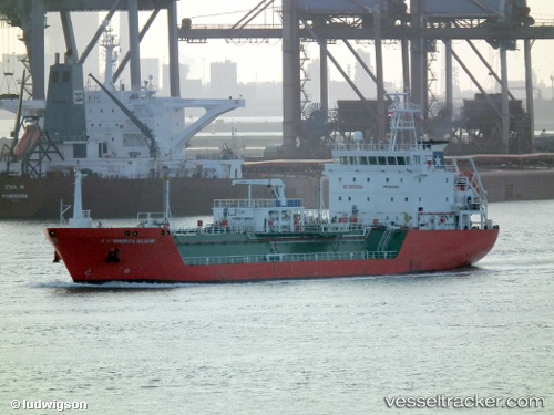
Vessel profile: Syn Turais is a Lpg Tanker with dimensions 16m x 95m.
This page combines live AIS, route history, probable destination signals, nearby traffic, and port activity for practical vessel monitoring.
The current position of vessel Syn Turais is 51.46558 lat / 3.71557 lng. Updated: 2026-05-29 09:57:02 UTCNearest reference points:
- Near Nieuwdorp
- Near BASTIAAN DE LANGEPLA
- Near Borssele
Details:
Live Vessel Syn Turais Analytics (details, animations, etc.)
Recent AIS points (UTC):
2026-05-29 05:36:39 UTC · 51.46564, 3.71553 · SOG 0 kn · COG 331°2026-05-29 07:57:06 UTC · 51.46562, 3.71555 · SOG 0 kn · COG 331°
2026-05-29 08:00:05 UTC · 51.46558, 3.71554 · SOG 0 kn · COG 331°
2026-05-29 09:57:02 UTC · 51.46558, 3.71557 · SOG 0 kn · COG 331°