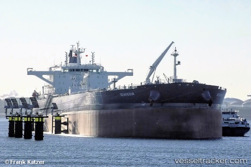
Seavigour
Current StatusWhere is the vessel?
Seavigour is currently in 80 nm SW of Walvisbaai, based on AIS data received about 7d ago.
Latest AIS update:
Current position: 23.62024° S, 13.24421° E (80 nm SW of Walvisbaai)
Average speed (last 7 days): Loading…
Average speed (last 30 days): Loading…
Vessel profile: Seavigour is a Crude Oil Tanker with dimensions 48m x 274m.
This page combines live AIS, route history, probable destination signals, nearby traffic, and port activity for practical vessel monitoring.
The current position of vessel Seavigour is -23.62024 lat / 13.24421 lng. Updated: 2026-06-09 21:51:52 UTCNearest reference points:
- Near WALVIS BAY
- 161 nm W of Walvisbaai
- 151 nm W of Henties Bay (Hentiesbaai)
Details:
Live Vessel Seavigour Analytics (details, animations, etc.)
Recent AIS points (UTC):
2026-06-09 21:51:52 UTC · -23.62024, 13.24421 · SOG 10.9 kn · COG 342°2026-06-09 21:51:52 UTC · -23.62024, 13.24421 · SOG 10.9 kn · COG 342°
2026-06-09 21:51:52 UTC · -23.62024, 13.24421 · SOG 10.9 kn · COG 342°
2026-06-09 21:51:52 UTC · -23.62024, 13.24421 · SOG 10.9 kn · COG 342°