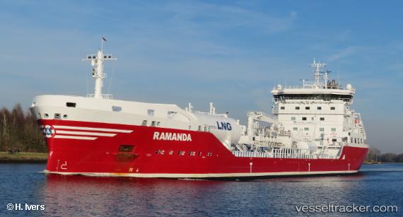
 Ramanda
Current Status
Where is the vessel?
Ramanda is currently in Near Ijmuiden, based on AIS data received about 14h ago.
Latest AIS update:
Current position: 52.51632° N, 4.34594° E (Near Ijmuiden)
Average speed (last 7 days): Loading…
Average speed (last 30 days): Loading…
Vessel profile: Ramanda is a Chemical Oil Products Tanker with dimensions 150m x 23m.
This page combines live AIS, route history, probable destination signals, nearby traffic, and port activity for practical vessel monitoring.
The current position of vessel Ramanda is 52.51632 lat / 4.34594 lng. Updated: 2026-06-24 10:50:18 UTCNearest reference points:
- Near Ijmuiden
- Near IJmuiden/Velsen
- Near de Ruyter
Currently sailing under the flag of Sweden ![]()
Details:
Live Vessel Ramanda Analytics (details, animations, etc.)
Recent AIS points (UTC):
2026-06-24 07:35:19 UTC · 52.51396, 4.34422 · SOG 0 kn · COG 51°2026-06-24 08:23:12 UTC · 52.51520, 4.34330 · SOG 0.3 kn · COG 89°
2026-06-24 09:53:19 UTC · 52.51633, 4.34585 · SOG 0 kn · COG 179°
2026-06-24 10:50:18 UTC · 52.51632, 4.34594 · SOG 0 kn · COG 181°