 vesseltracker.com
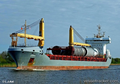
Jork
Current StatusWhere is the vessel?
Jork is currently in 87 nm SW of Saint-Pierre, based on AIS data received less than 1h ago.
Latest AIS update:
Current position: 45.81696° N, 57.75681° W (87 nm SW of Saint-Pierre)
Average speed (last 7 days): Loading…
Average speed (last 30 days): Loading…
Vessel profile: Jork is a General Cargo Ship with dimensions 18m x 146m.
This page combines live AIS, route history, probable destination signals, nearby traffic, and port activity for practical vessel monitoring.
The current position of vessel Jork is 45.81696 lat / -57.75681 lng. Updated: 2026-05-15 19:44:59 UTCNearest reference points:
- Near SAINT PIERRE
- Near MIQUELON
- Near Fortune
Details:
Live Vessel Jork Analytics (details, animations, etc.)
Recent AIS points (UTC):
2026-05-15 16:25:19 UTC · 46.15833, -58.13333 · SOG 7 kn · COG -1°2026-05-15 16:46:16 UTC · 46.12500, -58.09500 · SOG 8 kn · COG -1°
2026-05-15 17:22:18 UTC · 46.06333, -58.02667 · SOG 7 kn · COG -1°
2026-05-15 19:44:59 UTC · 45.81696, -57.75681 · SOG 8.2 kn · COG 144°