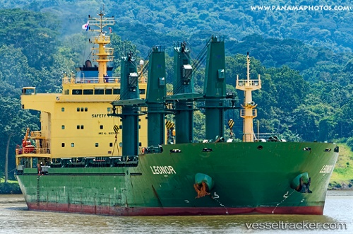
Leonor
Current StatusWhere is the vessel?
Leonor is currently in Open sea (no nearby ports in database), based on AIS data received about 14h ago.
Latest AIS update:
Current position: 14.98333° S, 1.79167° E (Open sea (no nearby ports in database))
Average speed (last 7 days): Loading…
Average speed (last 30 days): Loading…
Vessel profile: Leonor is a Bulk Carrier with dimensions 28m x 180m.
This page combines live AIS, route history, probable destination signals, nearby traffic, and port activity for practical vessel monitoring.
The current position of vessel Leonor is -14.98333 lat / 1.79167 lng. Updated: 2026-07-09 22:00:18 UTCNearest reference points:
- Open sea (no nearby ports in database)
Details:
Live Vessel Leonor Analytics (details, animations, etc.)
Recent AIS points (UTC):
2026-07-09 18:24:20 UTC · -14.48167, 1.40167 · SOG 10 kn · COG -1°2026-07-09 19:33:18 UTC · -14.63833, 1.52500 · SOG 10 kn · COG -1°
2026-07-09 20:00:18 UTC · -14.70167, 1.57333 · SOG 10 kn · COG -1°
2026-07-09 22:00:18 UTC · -14.98333, 1.79167 · SOG 10 kn · COG -1°