 Da De
Da De
Current Status
Where is the vessel?
Da De is currently in Near Penglai Pt, based on AIS data received about 14h ago.
Latest AIS update:
Current position: 37.82215° N, 120.84436° E (Near Penglai Pt)
Average speed (last 7 days): Loading…
Average speed (last 30 days): Loading…
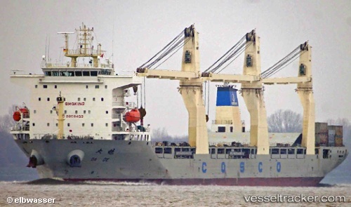
Vessel profile: Da De is a Multi Purpose Carrier with dimensions 180m x 28m.
This page combines live AIS, route history, probable destination signals, nearby traffic, and port activity for practical vessel monitoring.
The current position of vessel Da De is 37.82215 lat / 120.84436 lng. Updated: 2026-06-27 03:22:02 UTCNearest reference points:
- 16 nm E of Changdao
- 14 nm NW of Yantai
- 18 nm N of Changdao
Currently sailing under the flag of China ![]()
Details:
Live Vessel Da De Analytics (details, animations, etc.)
Recent AIS points (UTC):
2026-06-26 23:54:17 UTC · 37.93496, 120.94269 · SOG 0 kn · COG 0°2026-06-27 01:34:34 UTC · 37.86401, 120.91107 · SOG 13.7 kn · COG 270°
2026-06-27 02:37:02 UTC · 37.82211, 120.84432 · SOG 0.3 kn · COG 113°
2026-06-27 03:22:02 UTC · 37.82215, 120.84436 · SOG 0 kn · COG 113°