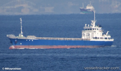
 Taiko Maru
Current Status
Where is the vessel?
Taiko Maru is currently in Near Minato-Ku, Osaka, based on AIS data received about 15h ago.
Latest AIS update:
Current position: 34.67152° N, 135.45058° E (Near Minato-Ku, Osaka)
Average speed (last 7 days): Loading…
Average speed (last 30 days): Loading…
Vessel profile: Taiko Maru is a General Cargo Ship with dimensions 63m x 10m.
This page combines live AIS, route history, probable destination signals, nearby traffic, and port activity for practical vessel monitoring.
The current position of vessel Taiko Maru is 34.67152 lat / 135.45058 lng. Updated: 2026-05-22 12:08:14 UTCNearest reference points:
- Near SAKAI
- Near Nada-Ku, Hyogo
- Near Kobe
Currently sailing under the flag of Japan ![]()
Details:
Live Vessel Taiko Maru Analytics (details, animations, etc.)
Recent AIS points (UTC):
2026-05-22 08:20:12 UTC · 34.67154, 135.45058 · SOG 0 kn · COG 156°2026-05-22 09:29:11 UTC · 34.67151, 135.45058 · SOG 0 kn · COG 157°
2026-05-22 10:26:13 UTC · 34.67151, 135.45055 · SOG 0.1 kn · COG 157°
2026-05-22 12:08:14 UTC · 34.67152, 135.45058 · SOG 0 kn · COG 156°