 Glovis Chorus
Current Status
Where is the vessel?
Glovis Chorus is currently in Near PYEONGTAEK, based on AIS data received about 14h ago.
Latest AIS update:
Current position: 36.98325° N, 126.82389° E (Near PYEONGTAEK)
Average speed (last 7 days): Loading…
Average speed (last 30 days): Loading…
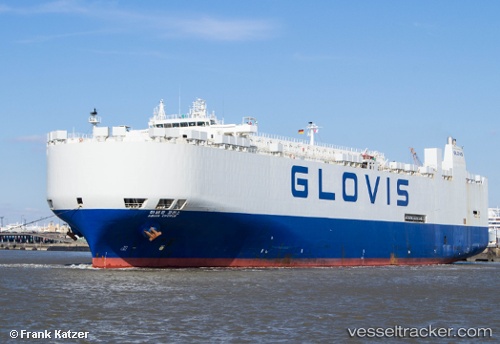
Vessel profile: Glovis Chorus is a Vehicles Carrier with dimensions 200m x 32m.
This page combines live AIS, route history, probable destination signals, nearby traffic, and port activity for practical vessel monitoring.
The current position of vessel Glovis Chorus is 36.98325 lat / 126.82389 lng. Updated: 2026-06-25 10:06:04 UTCNearest reference points:
- Near PYEONGTAEK
- Near Dangjin
- Near Incheon
Currently sailing under the flag of Korea ![]()
Glovis Chorus built in 1997 year
Deadweight:
21505 tDetails:
Live Vessel Glovis Chorus Analytics (details, animations, etc.)
Recent AIS points (UTC):
2026-06-25 05:24:04 UTC · 36.98324, 126.82393 · SOG 0.1 kn · COG 330°2026-06-25 07:06:04 UTC · 36.98324, 126.82391 · SOG 0 kn · COG 330°
2026-06-25 08:30:04 UTC · 36.98326, 126.82391 · SOG 0.1 kn · COG 330°
2026-06-25 10:06:04 UTC · 36.98325, 126.82389 · SOG 0 kn · COG 330°