 Max Schulte
Current Status
Where is the vessel?
Max Schulte is currently in 48 nm SE of Little Torch Key, based on AIS data received about 14h ago.
Latest AIS update:
Current position: 24.04061° N, 80.81834° W (48 nm SE of Little Torch Key)
Average speed (last 7 days): Loading…
Average speed (last 30 days): Loading…
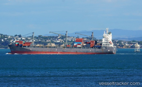
Vessel profile: Max Schulte is a Container Ship with dimensions 189m x 30m.
This page combines live AIS, route history, probable destination signals, nearby traffic, and port activity for practical vessel monitoring.
The current position of vessel Max Schulte is 24.04061 lat / -80.81834 lng. Updated: 2026-05-25 01:19:42 UTCNearest reference points:
- 28 nm NE of VARADERO
- Near Summerland Key
- Near Key West
Currently sailing under the flag of Singapore ![]()
Details:
Live Vessel Max Schulte Analytics (details, animations, etc.)
Recent AIS points (UTC):
2026-05-24 21:59:30 UTC · 24.52534, -80.00514 · SOG 15.8 kn · COG -1°2026-05-24 21:59:30 UTC · 24.52534, -80.00514 · SOG 15.8 kn · COG -1°
2026-05-25 00:17:25 UTC · 24.18827, -80.55536 · SOG 15.8 kn · COG -1°
2026-05-25 01:19:42 UTC · 24.04061, -80.81834 · SOG 16 kn · COG 233°