 vesseltracker.com
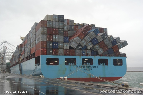
Maersk Sembawang
Current StatusWhere is the vessel?
Maersk Sembawang is currently in 66 nm SW of Sagres, based on AIS data received about 1h ago.
Latest AIS update:
Current position: 36.07985° N, 9.69011° W (66 nm SW of Sagres)
Average speed (last 7 days): Loading…
Average speed (last 30 days): Loading…
Vessel profile: Maersk Sembawang is a Container Ship with dimensions 40m x 319m.
This page combines live AIS, route history, probable destination signals, nearby traffic, and port activity for practical vessel monitoring.
The current position of vessel Maersk Sembawang is 36.07985 lat / -9.69011 lng. Updated: 2026-05-15 17:19:18 UTCNearest reference points:
- 31 nm SW of Sagres
- 54 nm W of Sagres
- 18 nm S of Sagres
Details:
Live Vessel Maersk Sembawang Analytics (details, animations, etc.)
Recent AIS points (UTC):
2026-05-15 13:49:58 UTC · 36.03730, -8.27087 · SOG 19.7 kn · COG 274°2026-05-15 15:54:47 UTC · 36.06538, -9.12026 · SOG 19.6 kn · COG 275°
2026-05-15 16:14:36 UTC · 36.06962, -9.25301 · SOG 19.6 kn · COG 274°
2026-05-15 17:19:18 UTC · 36.07985, -9.69011 · SOG 19.5 kn · COG 274°