 vesseltracker.com
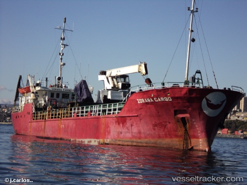
Iorana Cargo
Current StatusWhere is the vessel?
Iorana Cargo is currently in 20 nm W of QUINTERO, based on AIS data received about 15h ago.
Latest AIS update:
Current position: 32.78071° S, 71.90279° W (20 nm W of QUINTERO)
Average speed (last 7 days): Loading…
Average speed (last 30 days): Loading…
Vessel profile: Iorana Cargo is a General Cargo Ship with dimensions 9m x 51m.
This page combines live AIS, route history, probable destination signals, nearby traffic, and port activity for practical vessel monitoring.
The current position of vessel Iorana Cargo is -32.78071 lat / -71.90279 lng. Updated: 2026-05-18 12:02:47 UTCNearest reference points:
- Near Valparaiso
- 28 nm W of Pichilemu
- 100 nm W of Curauma
Details:
Live Vessel Iorana Cargo Analytics (details, animations, etc.)
Recent AIS points (UTC):
2026-05-18 08:16:56 UTC · -32.51725, -72.19327 · SOG 5.4 kn · COG 146°2026-05-18 09:59:07 UTC · -32.63210, -72.05834 · SOG 5.9 kn · COG 152°
2026-05-18 11:10:37 UTC · -32.71420, -71.95846 · SOG 5.7 kn · COG 154°
2026-05-18 12:02:47 UTC · -32.78071, -71.90279 · SOG 5.5 kn · COG 146°