Belfast
Current StatusWhere is the vessel?
Belfast is currently in 44 nm N of Bali, based on AIS data received about 15h ago.
Latest AIS update:
Current position: 25.86723° N, 121.59013° E (44 nm N of Bali)
Average speed (last 7 days): Loading…
Average speed (last 30 days): Loading…
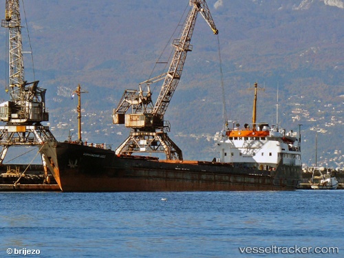
Vessel profile: Belfast is a General Cargo Ship with dimensions 13m x 114m.
This page combines live AIS, route history, probable destination signals, nearby traffic, and port activity for practical vessel monitoring.
The current position of vessel Belfast is 25.86723 lat / 121.59013 lng. Updated: 2026-07-04 10:13:39 UTCNearest reference points:
- 11 nm NE of Bali
- 66 nm SE of Sansha
- Near Chi-Lung
Details:
Live Vessel Belfast Analytics (details, animations, etc.)
Recent AIS points (UTC):
2026-07-04 07:31:36 UTC · 25.86697, 121.59028 · SOG 0.2 kn · COG 260°2026-07-04 07:51:42 UTC · 25.86700, 121.59031 · SOG 0.1 kn · COG 254°
2026-07-04 09:50:40 UTC · 25.86710, 121.59028 · SOG 0.5 kn · COG 251°
2026-07-04 10:13:39 UTC · 25.86723, 121.59013 · SOG 0.2 kn · COG -1°