 vesseltracker.com
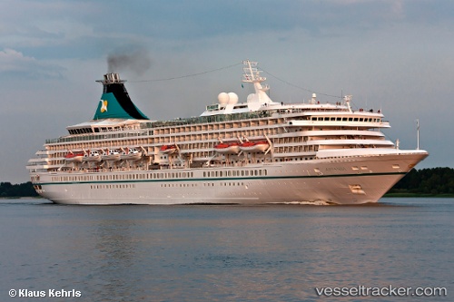
Artania
Current StatusWhere is the vessel?
Artania is currently in Near Bremerhaven, based on AIS data received less than 1h ago.
Latest AIS update:
Current position: 53.56153° N, 8.55089° E (Near Bremerhaven)
Average speed (last 7 days): Loading…
Average speed (last 30 days): Loading…
Vessel profile: Artania is a Cruise Ship with dimensions 32m x 230m.
This page combines live AIS, route history, probable destination signals, nearby traffic, and port activity for practical vessel monitoring.
The current position of vessel Artania is 53.56153 lat / 8.55089 lng. Updated: 2026-05-17 05:29:24 UTCNearest reference points:
- Near Bremerhaven
- Near Sandstedt
- Near Brake
Details:
Live Vessel Artania Analytics (details, animations, etc.)
Recent AIS points (UTC):
2026-05-17 01:49:21 UTC · 53.87569, 7.77088 · SOG 9.7 kn · COG 107°2026-05-17 03:46:03 UTC · 53.66492, 8.38172 · SOG 13.4 kn · COG 140°
2026-05-17 04:05:31 UTC · 53.62119, 8.47198 · SOG 12 kn · COG 128°
2026-05-17 05:29:24 UTC · 53.56153, 8.55089 · SOG 0 kn · COG 331°