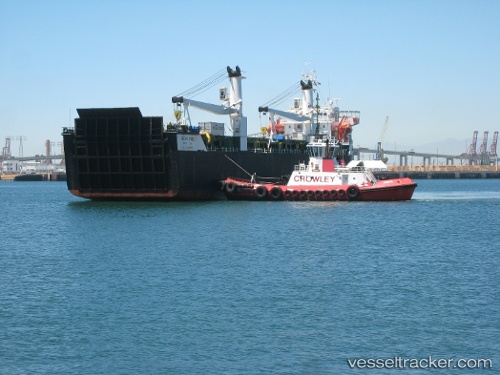
 MINI STAR
Current Status
Where is the vessel?
MINI STAR is currently in Near Marina di Massa, based on AIS data received about 138d ago.
Latest AIS update:
Current position: 43.98960° N, 10.03086° E (Near Marina di Massa)
Average speed (last 7 days): Loading…
Average speed (last 30 days): Loading…
Vessel profile: MINI STAR is a Heavy Load Carrier with dimensions 20m x 106m.
This page combines live AIS, route history, probable destination signals, nearby traffic, and port activity for practical vessel monitoring.
The current position of vessel MINI STAR is 43.98960 lat / 10.03086 lng. Updated: 2026-01-06 13:12:12 UTCNearest reference points:
- Near Ortonova, Isola
- Near La Spezia
- Near Viareggio
Currently sailing under the flag of St.Kitts and Nevis ![]()
MINI STAR built in 1983 year
Deadweight:
4393 tDetails:
Live Vessel MINI STAR Analytics (details, animations, etc.)
Recent AIS points (UTC):
2026-01-06 13:12:12 UTC · 43.98960, 10.03086 · SOG 0 kn · COG 307°