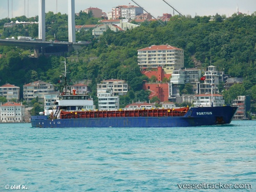
 Fortius
Current Status
Where is the vessel?
Fortius is currently in 16 nm E of Constanta, based on AIS data received about 14h ago.
Latest AIS update:
Current position: 44.15352° N, 29.03815° E (16 nm E of Constanta)
Average speed (last 7 days): Loading…
Average speed (last 30 days): Loading…
Vessel profile: Fortius is a General Cargo Ship with dimensions 74m x 11m.
This page combines live AIS, route history, probable destination signals, nearby traffic, and port activity for practical vessel monitoring.
The current position of vessel Fortius is 44.15352 lat / 29.03815 lng. Updated: 2026-05-19 16:43:27 UTCNearest reference points:
- 20 nm E of Eforie Sud
- Near Constanta
- Near MIDIA
Currently sailing under the flag of Vanuatu ![]()
Fortius built in 1985 year
Deadweight:
1753 tDetails:
Live Vessel Fortius Analytics (details, animations, etc.)
Recent AIS points (UTC):
2026-05-19 13:21:43 UTC · 44.15340, 29.03798 · SOG 0 kn · COG 209°2026-05-19 14:22:16 UTC · 44.15349, 29.03798 · SOG 0 kn · COG 206°
2026-05-19 16:01:44 UTC · 44.15348, 29.03817 · SOG 0 kn · COG 220°
2026-05-19 16:43:27 UTC · 44.15352, 29.03815 · SOG 0 kn · COG 221°