 vesseltracker.com
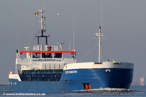
 Irem Kaan
Current Status
Where is the vessel?
Irem Kaan is currently in Near Catania, based on AIS data received less than 1h ago.
Latest AIS update:
Current position: 37.49248° N, 15.09372° E (Near Catania)
Average speed (last 7 days): Loading…
Average speed (last 30 days): Loading…
Vessel profile: Irem Kaan is a General Cargo Ship with dimensions 88m x 12m.
This page combines live AIS, route history, probable destination signals, nearby traffic, and port activity for practical vessel monitoring.
The current position of vessel Irem Kaan is 37.49248 lat / 15.09372 lng. Updated: 2026-05-15 15:35:23 UTCNearest reference points:
- Near Riposto
- Near Punta Cugno
- Near Augusta
Currently sailing under the flag of Turkey ![]()
Irem Kaan built in 1985 year
Deadweight:
3048 tDetails:
Live Vessel Irem Kaan Analytics (details, animations, etc.)
Recent AIS points (UTC):
2026-05-15 11:45:57 UTC · 37.49247, 15.09372 · SOG 0 kn · COG 97°2026-05-15 13:09:42 UTC · 37.49248, 15.09372 · SOG 0 kn · COG 97°
2026-05-15 13:30:43 UTC · 37.49248, 15.09372 · SOG 0 kn · COG 97°
2026-05-15 15:35:23 UTC · 37.49248, 15.09372 · SOG 0 kn · COG 97°