 Dolfijn
Current Status
Where is the vessel?
Dolfijn is currently in Near Little Thurrock, based on AIS data received about 14h ago.
Latest AIS update:
Current position: 51.46415° N, 0.34060° E (Near Little Thurrock)
Average speed (last 7 days): Loading…
Average speed (last 30 days): Loading…
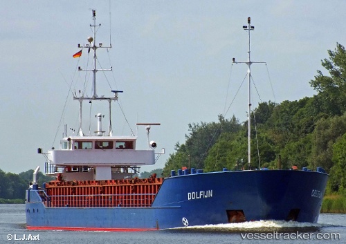
Vessel profile: Dolfijn is a General Cargo Ship with dimensions 81m x 12m.
This page combines live AIS, route history, probable destination signals, nearby traffic, and port activity for practical vessel monitoring.
The current position of vessel Dolfijn is 51.46415 lat / 0.34060 lng. Updated: 2026-05-20 11:49:13 UTCNearest reference points:
- Near Gravesend
- Near GILLINGHAM
- Near Blackheath/London
Currently sailing under the flag of Antigua Barbuda ![]()
Dolfijn built in 1989 year
Deadweight:
2450 tDetails:
Live Vessel Dolfijn Analytics (details, animations, etc.)
Recent AIS points (UTC):
2026-05-20 08:04:15 UTC · 51.46419, 0.34061 · SOG 0 kn · COG 339°2026-05-20 09:40:12 UTC · 51.46420, 0.34057 · SOG 0 kn · COG 339°
2026-05-20 10:25:10 UTC · 51.46412, 0.34063 · SOG 0 kn · COG 339°
2026-05-20 11:49:13 UTC · 51.46415, 0.34060 · SOG 0 kn · COG 339°